Regional Land Use Plan (PRAS-GBP)
© PRAS/GBP

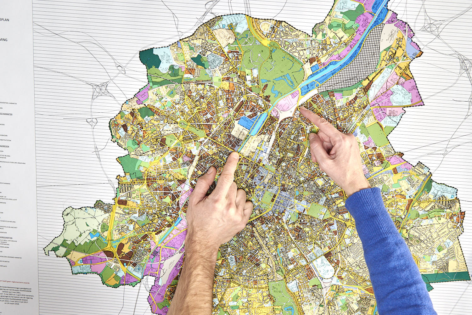
The Regional Land Use Plan (PRAS-GBP) is the essential tool for urban development in an ever evolving region. For each plot of land in the Brussels Region, the Plan determines whether it is constructible or not (green areas, protected areas, etc.). And if it is, what types of constructions (housing, offices, shops, etc.) are allowed. It therefore defines land uses.
Adopted by the Government of the Brussels-Capital Region on 3 May 2001, the Regional Land Use Plan (PRAS-GBP) is at the top of the hierarchy of regulatory plans for territorial development. The PRAS is enforceable against third parties, i.e. it is binding on both authorities and individuals. Each planning permission application must comply with it.
Since 2001, it has been subject to partial modifications and errata. In 20 years, the Brussels Region has changed a great deal, acquiring important new competences as a result of successive State reforms. Moreover, like all the world's metropolises, it is facing new urban challenges, in the form of climate, health, nature in the city, creation of housing and activities, etc.
The PRAS will therefore be thoroughly updated to respond to the transformations in society. The Brussels Government has entrusted perspective.brussels with the task of revising this plan. This work is being carried out jointly with public and private stakeholders.
What does the Regional Land Use Plan include?
The Regional Land Use Plan (PRAS) operates around:
- six maps, the most important of which is the land use map;
- literal, precise and binding requirements.
The maps
The PRAS contains six maps:
- The map of the de facto existing situation. This map is indicative and establishes the distribution of existing activities and the level of mix throughout the territory of the Brussels-Capital Region. It is a snapshot of the Region at a given time.
- The map of the existing legal situation. It is indicative and brings together all the legal provisions concerning urban planning, heritage protection, urban renewal and environmental protection
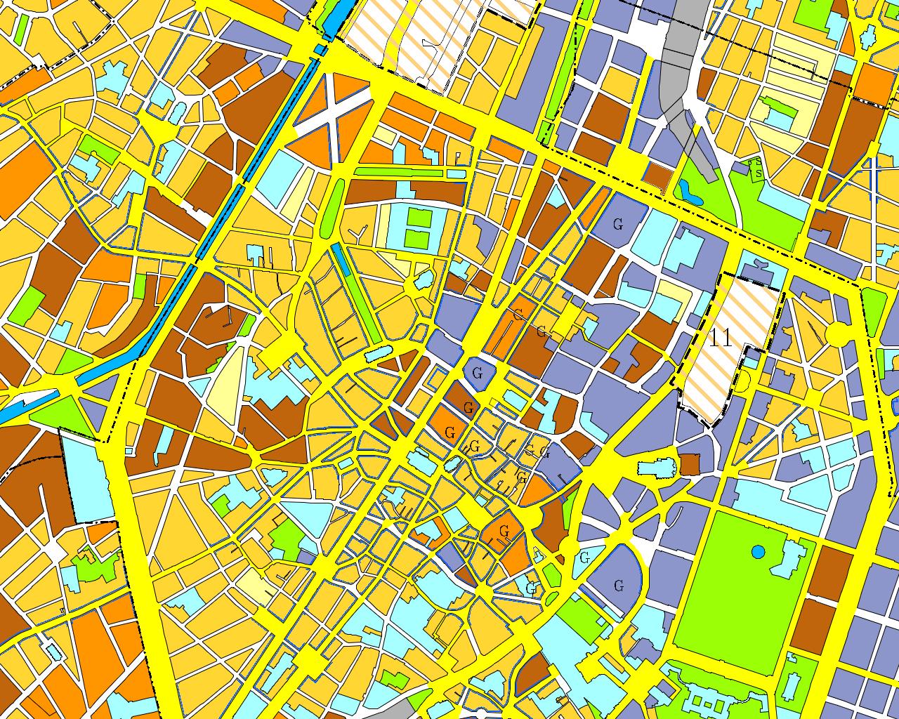
- The land use map. It has regulatory status and divides the territory of the Region according to the authorised uses (housing, businesses, equipment, green spaces, etc.).
- The map of admissible office space (CaSBA). This map divides the Region's territory into 132 grids in which the admissible office space is indicated in m². Developments (updated regularly) are monitored via the site https://casba.urban.brussels/.
- The road map. This map is regulatory and includes the primary road network (motorways, metropolitan roads and main roads).
- The public transport map. This map is regulatory and contains the structure of the public transit network (rail lines and independent routes, i.e. the dedicated network and underground network).
Literal requirements
The book of literal requirements contains:
- The general requirements relating to all the zones. With some exceptions, the general requirements apply to all areas of the PRAS-GBP.
- The specific requirements relating to the various zones of the land use map (housing, businesses, equipment, green spaces, etc.).
- The special requirements for roads and public transport.
- The programme of Areas of Regional Interest (ZIR-GGB) and Areas of Regional Interest for Deferred Development (ZIRAD-GGBUA).
- The glossary of the main terms used in the urban planning requirements. This glossary is useful for other purposes.
How to develop and modify the PRAS-GBP?
The modalities for the development and amendment of the PRAS-GBP are defined in the CoBAT (Articles 25 and 27):
- the Government approves the draft PRAS-GBP or the draft partial amendment of the PRAS-GBP;
- it submits the draft Plan and its Environmental Impact Report (EIR) to a 60-day public inquiry in each of the 19 municipalities of the Region. Any citizen may submit complaints and observations to the Government within the time limits of the inquiry;
- the administration, Brussels Environment, the regional bodies to be consulted and the municipalities are invited to give their opinion on the draft Plan within the time limits of the inquiry. The other regions are also invited to give their opinion if required;
- after the public inquiry, the Government submits the draft Plan, EIR, claims and opinions to the Regional Development Commission (RDC). The RDC issues its opinion within 90 days;
- the Government definitively approves the Plan;
- the Plan enters into force 15 days after being published in the Belgian Official Gazette.
How is the PRAS-GBP review organised?
The Brussels Government has entrusted perspective.brussels with the task of revising this plan in depth.
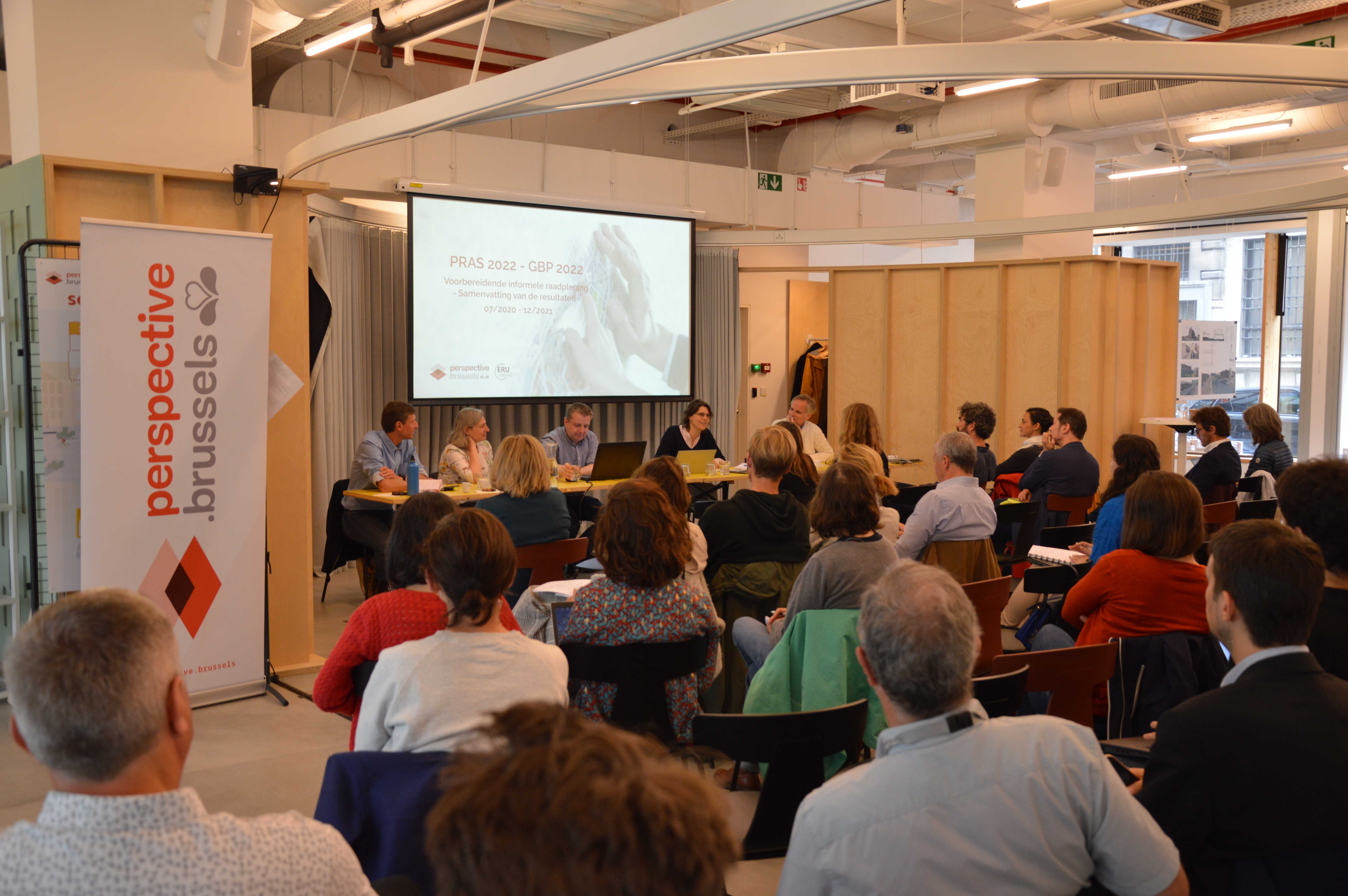
- An initial consultation was organised for the general public and all the Region's stakeholders, from 26 August to 15 October 2021.
- On 23 December 2021, the Brussels Government approved the decree formally opening the procedure for amending the PRAS-GBP.
- An information session was held on 1 June 2022 at Perspective with regional and municipal institutions. The objective was to refine the methodology and organise the work of the stakeholders in this project, which will structure the future of the Region.
- The next step is to identify the actual occupancy of each regional plot in order to establish a new "de facto existing situation" map (SitEx 2.0). This global image of the territory is essential for basing strong, objective public policies in terms of territorial development. In concrete terms, over the next few months, specially trained researchers will examine the evolution of the Region's territory in the field and compare the real situation with the situation known to the regional services. Once this important collection work is completed, the map of the existing de facto situation will be updated.
- In parallel with this field survey, a collective work process will involve the stakeholders in defining the findings, issues and avenues for work. These working groups will address a series of themes that are essential for the future of the Region (mixed use, density, biodiversity and urban agriculture, mobility, etc.). This co-construction will allow the different stakeholders to contribute their expertise and to find a balance between the different functions of the territory.